
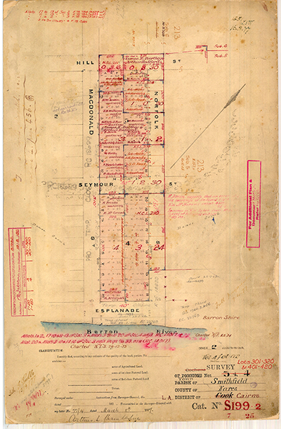
Map S199.2, Smithfield, 1877
Dublin Core
Title
Map S199.2, Smithfield, 1877
Identifier
Map S199.2
Description
Survey of Sections Nos. 3 + 4 (Lots 301-320, & 401-420), Town of Smithfield, County of Nares, Land Administration District of Cairns, District of Cook, Cat. S199.2.
Signed and dated 'Arthur L. Chamberlin, 77/4, March 8th 1877'.
Creator
Arthur L. Chamberlin [Queensland Land Surveyor]
Subject
Cadastral maps;
Cartography;
Chamberlin, Arthur L.;
Mapping;
Queensland. Department of Mapping & Surveying;
Queensland--History--Maps;
Surveying & Surveyors;
Surveying--Australia--Queensland;
Surveyors -- Queensland -- History -- 19th century.
Cartography;
Chamberlin, Arthur L.;
Mapping;
Queensland. Department of Mapping & Surveying;
Queensland--History--Maps;
Surveying & Surveyors;
Surveying--Australia--Queensland;
Surveyors -- Queensland -- History -- 19th century.
Date
8 March 1877
Publisher
Department of Natural Resources, Mines and Energy, Queensland Government
Format
Paper map
Scale 2 chains to an inch (1:1584)
Scale 2 chains to an inch (1:1584)
Type
Still Image
Coverage
165138S1454201E
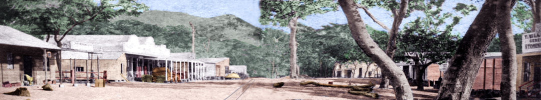
Old Smithfield township, Barron QLD 4871
Colonial Queensland
1870s
Old Smithfield township, Barron QLD 4871
Colonial Queensland
1870s
Rights
This page © 2021 oldsmithfield.com
Original item held at the Department of Natural Resources, Mines and Energy, Queensland Government, Brisbane.
Original item held at the Department of Natural Resources, Mines and Energy, Queensland Government, Brisbane.
Relation
See also:


Map S199.1, Smithfield, 1876
Survey of Sections Nos. 1 + 2 (Lots 1-20, & 201-220), Town of Smithfield, County of Nares, Land Administration District of Cairns, District of…
Surveyor's Field Book, S199.2, Smithfield 1877
16-page surveyor's field book showing survey transects, theodolite angles, chained distances, marked trees and field observations.Title page…
Embed
Copy the code below into your web page
Item Relations
| Item: Surveyor's Field Book, S199.2, Smithfield 1877 | is related to | This Item |
| Item: Map S199.1, Smithfield, 1876 | is related to | This Item |
Collection
Citation
Arthur L. Chamberlin [Queensland Land Surveyor], “Map S199.2, Smithfield, 1877,” 8 March 1877, Map S199.2, Department of Natural Resources, Mines and Energy, Queensland Government, https://www.oldsmithfield.com/omeka/items/show/18.